Preface
After thousands of years of development history, the subject of surveying and mapping, through the accumulation of many famous and outstanding scientists and scholars, with their hard work and sweat crystallization of rich results, glows with eternal brilliance. In the past 30 years, with the rapid development of science and technology,surveying and mapping science has entered a new era of informatization. Many new research contents and achievements reflecting characteristics of modern science and technology have emerged, which makes the content and technology of the whole surveying and mapping discipline not enough to be generalized and described by “vast as the sea”, and truly makes people understand the meaning of “a feast for eyes”.
Modern surveying and mapping science, with the rapid development of national economy and the progress of world science and technology, makes the theory and content of research, applied technology and methods into a deeper and new stage. With the combination of satellite technology, space vehicle, modern computer and network technology, communication technology, driven by development goals of digital earth,digital China and digital provinces, the mapping science has undergone great changes. It is difficult for every learner to understand and master all the knowledge of such a large and profound surveying subject. Therefore, it is necessary and appropriate to divide the surveying and mapping discipline into five branches according to its classification characteristics and system structure, namely geodesy, photogrammetry and remote sensing,cartography and geographic information engineering, engineering surveying and marine surveying and mapping. Generally speaking, every surveying and mapping worker is only engaged in the study and research of related contents of one branch of the discipline, so it is difficult to have a deeper understanding of the whole picture and development of surveying and mapping discipline. The content and purpose of this book is to facilitate a more comprehensive preliminary understanding of the whole of surveying and mapping,avoid being too professional and lack of a comprehensive understanding of surveying and mapping discipline, and meet the learning content set up by learners to deeply understand the new progress of modern surveying and mapping Science and technology.
The development of modern surveying and mapping discipline requires that surveying and mapping workers should not only study and research in this discipline and the scope of this specialty, but also broaden the scope of professional knowledge, and more combine the learning of theories and technologies of other disciplines beyond this specialty and even other disciplines that seem to be less relevant. In this regard, the first condition is to have a comprehensive and systematic understanding of the research content,theory, advanced technology and methods, discipline development and tasks of the discipline. Only by “accumulating widely and developing thinly” can we deeply study surveying and mapping technology and theory, innovate subject content and promote the development of surveying and mapping subject.
前 言
测绘学科经几千年发展历史的厚积,经众多名望卓越的科学家和学者,用心血和汗水结晶而成的丰硕成果的凝聚,使测绘学科焕发着经久不衰的灿烂辉煌。近 30年以来,随着科技的飞速发展,测绘科学已迈入了信息化的全新时期,众多反映了现代科技特色的新研究内容和研究成果涌现,使整个测绘学科的内容和技术,不足以用“浩瀚如海”所能概括和形容,真正使人领悟到了“美不胜收”的含义。
现代测绘科学,随着国民经济的飞速发展和世界科技的进步,使研究的理论和内容、应用的技术和方法进入了更深层次的新阶段。结合卫星技术、空间飞行器、现代计算机及网络技术、通信技术、在数字地球、数字中国、数字省区发展目标的驱动下,测绘科学发生了“翻天覆地”的变革。每个学习者要深入了解和精通如此庞大而又深奥的测绘学科的全部知识是困难的。因此按照学科分类特征和体系结构把测绘学科分为五大分支学科,即大地测量学、摄影测量学与遥感、地图制图学与地理信息工程、工程测量学、海洋测绘学是十分必要和恰当的。通常而言,每个测绘工作者仅从事于其中一个分支学科的相关内容学习和研究,难以对测绘学科的全貌及发展有更深程度的了解。本书的内容及目的,就是为了便于达到较全面地初步了解测绘学的整体,避免过于专业化而缺乏对测绘学科的全面认识,满足学习者深入了解现代测绘科学和技术的新进展而设置的学习内容。
现代测绘学科的发展,要求测绘工作者,不应仅局限于本学科及本专业范围的学习和研究,还要拓宽专业知识面,要更多地结合本专业以外的甚至其他似乎不太相关的学科理论及技术的学习。对此,首要的条件是必须全面而系统地了解本学科的研究内容及理论、先进技术及方法、学科发展和任务。“广积而薄发”才能深层次地研究测绘技术和理论,创新学科内容,推动测绘学科的发展。

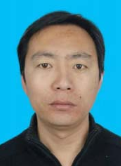
Xiao-Qiang Han, male, the Han nationality, bachelor’s degree, born in Fengrun District of Hebei Province in October 1972. He has presided over several national key engineeringprojects: Luangang Railway Survey, Delimitation and Mapping, China-Burmar Crude Oil,Natural Gas and Yunnan Refined Oil Pipeline Engineering Survey, Hebei Mining Rights Field Inspection, Tangshan Downtown Area Cadastral Survey in Tangshan Survey Area,and the second and third national land survey projects. He have won the “Excellent Geographic Information Achievement Award” and “Science and Technology Progress Award” by Hebei Geographic Information Bureau and the Surveying and Mapping Association. He was awarded the title of “Hebei Provincial Surveying and Mapping Young Technology Leader” in 2014 and the title of “Advanced Individual” in 2017 by the Hebei Bureau of Geology and Mineral Resources Exploration.
韩晓强,男,汉族, 1972 年 10 月生,河北丰润人,本科。多次主持国家重点工程项目:滦港铁路勘测定界测绘、中缅原油、天然气和云南成品油管道工程测量、河北省矿业权实地核查、唐山测区唐山市中心城区地籍调查,全国第二次、第三次土地调查项目等,多次荣获河北省地理信息局、测绘协会优秀地理信息成果奖、科技进步奖。 2014 年荣获“河北省测绘青年科技带头人”称号,在河北省地矿局 2017年荣获“先进个人”称号。

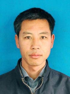
Guo-Ji Zhang, male, the Han nationality, bachelor’s degree, born in October 1972. His ancestral home is Hexigten Banner, Chifeng City, Inner Mongolia. He has been engaged in the mapping industry for 26 years. He has presided over the surveying of the Huangsongyu Reservoir spillway tunnel in Pinggu County, Beijing, and the surveying and demarcation of the Beijing-Tangshan intercity railway, the basic surveying and mapping C and D grade GPS network layout of Hangu management zone and Lutai economic development zone of Tangshan City. He participated in the second and third national land survey projects. He have won the “Excellent Engineering Award” and “Science and Technology Achievement Progress Award” by Hebei Geographic Information Bureau and the Surveying and Mapping Association for many times.
张国继,男,汉族, 1972 年 10 月生,内蒙古赤峰市克旗人,大学本科毕业。从事测绘行业 26 年, 曾主持北京平谷县黄松峪水库泄洪洞贯通测量工作、 北京至唐山城际铁路勘测定界工作,主持唐山市汉沽管理区与芦台经济开发区基础测绘 C、 D 级GPS 网布测工作,参加过全国第二次土地调查和第三次国土调查。多次获得河北省地理信息局和河北省测绘协会颁发优秀工程奖、科技成果进步奖。