Preface
Informatization is the trend of the times. In order to improve the efficiency of government organs, reduce the operating costs, and then provide efficient and efficient services for the people and enterprises and institutions, the government is promoting the informatization of government affairs, and promoting the legalization of government affairs activities with informatization. In order to reduce inventory, improve production efficiency and quality, and respond quickly, enterprises are promoting enterprise management informatization and providing information services to the society on demand. With the extensive and in-depth application of information technology represented by computer, network, mobile communication and artificial intelligence in all aspects of economic and
social development, information has become another important strategic resource after material and energy.
The results of surveying and mapping geographic information play a more and more important role in national security, economic and social development, information construction, natural resource management and emergency disposal. The quality of the results is related to the national economy and people’s livelihood and scientific decision-making of social development. At present, there are many types of surveying and mapping geographic information results, and it requires complex structure, fine technical requirements, large amount of data, high requirements of current situation, and wide service range. It is impossible to effectively and accurately detect and evaluate the quality status of Surveying and mapping geographic information results relying on manual or simple human-computer interaction inspection methods and means.
It is of great significance to study the new mode of quality inspection of surveying and mapping geographic information results under the information-based surveying and mapping system, construct the information-based quality inspection platform with management function, realize the classification management, rapid inspection and
evaluation of various results quality inspection, and improve the inspection efficiency and scientificity, which is of great significance to ensure the reliability of the application of surveying and mapping geographic information results.
前 言
信息化是当今时代发展的大趋势。政府为提高政府机关的办事效率、降低运作成本,进而为民众与企事业组织提供高效快捷服务,正在推进政务信息化,并以信息化带动政务活动的法制化;企业为达到降低库存、提高生产效能和质量、快速应变的目的,正在推进企业管理信息化,按需向社会提供信息化服务。随着计算机、网络、移动通信、人工智能等为代表的信息技术在经济社会发展方方面面的广泛深入的应用,信息已经成为继物质、能源之后的又一种重要战略性资源。
测绘地理信息成果在国家安全、经济社会发展、信息化建设、自然资源管理、突发事件应急处置中发挥着越来越重要的作用,其成果质量关系到国计民生和社会发展的科学决策。当前,测绘地理信息成果类型多、结构复杂、技术要求精细、数据量大、现势性要求高、服务范围广,依靠人工或简单的人机交互的检查方式和手段已无法高效准确地检测评估其质量状况。
研究信息化测绘体系下测绘地理信息成果的质量检验新模式,构建具有管理功能的信息化质检平台,实现多种成果质量检验的分类管理、快速检查与评价,提高检验效率和科学性,对于保障测绘地理信息成果应用的可靠性具有重要意义。

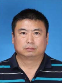
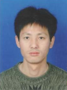
Xiao-Bin Sun, male, the Han nationality, bachelor’s degree, born in Shenyang City, Liaoning Province in October 1975. At present, he is the branch president of Liaoning Geological and Mineral Surveying and Mapping Institute Co., Ltd. In December 2010, he won the second prize of science and technology achievement award of Liaoning Provincial Department of Land and Resources; in 2015, he won the first prize of science and technology achievement award of Liaoning Provincial Department of Land and Resources.
孙孝斌,男,汉族, 1975 年 10 月生,辽宁沈阳人。本科学历,现任辽宁省地矿测绘院有限责任公司分院长。 2010 年 12 月获得辽宁省国土资源厅科学技术成果奖二等奖; 2015 年获得辽宁省国土资源厅科学技术成果奖一等奖。

Feng-Jun Bo, male, the Han nationality, specialized secondary school degree, senior engineer of surveying and mapping, born in Shenyang City, Liaoning Province in November 1973. He graduated from Nanjing Geological School in July 1994. At present, he is the branch president of Liaoning Geological and Mineral Surveying and Mapping Institute. He is mainly engaged in surveying and mapping engineering and has published several papers during his work.
薄凤军,男,汉族, 1973 年 11 月生,辽宁沈阳人。 1994 年 7 月毕业于江苏省南京市南京地质学校,中专学历。现任辽宁省地矿测绘院分院长,测绘高级工程师。主要从事测绘工程方面的工作与研究,工作期间发表过论文数篇。

Bo-Yang Yu, male, the Han nationality, bachelor’s degree, senior engineer, registered surveying and mapping engineer,born in Shenyang City, Liaoning Province in October 1983. In 2007, he graduated from Heilongjiang Institute of Technology. He is now the general manager of Borong Survey and Design Co., Ltd. He is mainly engaged in surveying and mapping engineering work and research. In the past ten years, he published several papers of great scientific research value, participated in many large-scale projects in Liaoning Province and served as the technical director.
于博洋,男,汉族, 1983 年 10 月生,辽宁沈阳人。 2007 年毕业于黑龙江工程学院,本科学历。现任博荣勘测设计有限公司总经理,高级工程师,注册测绘师,主要从事测绘工程方面的工作与研究。在十几年工作时间里,发表了颇具科研价值的论文若干,参与了很多辽宁省大型工程项目并担任其中的技术负责人。