Preface
The existence and development of human beings on the earth is inseparable from the determination of the location of points, the determination of boundary points and lines, the determination of the area of these places and the location of construction projects.Surveying science is developed to meet the needs of human survival and development and positioning technology of construction engineering. The task of construction engineering survey mainly includes mapping and surveying. Surveying and mapping refers to the use of measuring instruments and tools, through field measurement and calculation to obtain a series of measurement information, the earth's surface topography into a topographic map or compiled into data for economic construction, planning and design, scientific research and national defense construction.
Engineering survey usually refers to the general term of various survey theories, methods and engineering survey technologies used in the survey, design, construction and management stages of engineering construction. The service field of traditional engineering survey technology includes construction, water conservancy, transportation, mining and other industries, and its basic content includes mapping and lofting. Modern engineering survey has far broken through the concept of only serving engineering construction. It not only involves the measurement of static and dynamic geometric and physical quantities, but also includes the analysis of measurement results and even the prediction of the development trend of objects.
Today, China is in the tide of national informatization. The country should promote modernization and accelerate the economic and social development of our country by promoting informatization. It is in the context of national information construction that promotes the development of Surveying and mapping information. The demand of national economic construction and social sustainable development for geospatial information such as time, space and attribute or generalized surveying and mapping information is also growing rapidly. Surveying and mapping disciplines and industries are playing an increasingly important role in national informatization and modernization. In order to meet the needs of national information construction, surveying and mapping is beginning to enter a new stage of information surveying and mapping. Therefore, it puts forward higher requirements for the construction of Surveying and mapping talent team.
前 言
人类在地球上的生存、发展离不开点位置的确定,离不开边界点、边界线的确定, 离不开这些场所的面积以及建筑工程的位置测定。 测量科学正是适应人类生存、发展的需要和建筑工程建设的定位技术需求而发展起来。建筑工程测量的任务主要包括测绘和测设两部分。测绘是指使用测量仪器和工具,通过实地测量和计算得到一系列测量信息,把地球表面的地形绘成地形图或编制成数据资料,供经济建设、规划设计、科学研究和国防建设使用。
工程测量通常是指在工程建设的勘测设计、施工和管理阶段中运用的各种测量理论、方法和工程测量技术的总称。传统工程测量技术的服务领域包括建筑、水利、交通、矿山等行业,其基本内容有测图和放样两部分。现代工程测量已经远远突破了仅仅为工程建设服务的概念,它不仅涉及工程的静态、动态几何与物理量测定,而且包括对测量结果的分析,甚至对物体发展变化的趋势进行预报。
当今中国正处于国家信息化大潮之中,国家要通过推进信息化,促进现代化,加速我国经济、社会的发展。正是在国家信息化建设的大背景下促使测绘信息化的发展。国民经济建设和社会可持续发展对诸如时间、空间、属性这类地理空间信息或者说广义测绘信息的需求也在迅速增长。测绘学科和行业在国家信息化和现代化建设中发挥着越来越重要的作用。为了适应国家信息化建设的需求,测绘正开始步入信息化测绘新阶段。由此对测绘人才队伍建设提出了更高的要求。

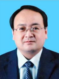
Xiu-Yong Wang, male, the Han nationality, bachelor’s degree, born in Rizhao City, Shandong Province in May 1974. He graduated from Shandong Agriculture and Engineering University. His research direction is surveying and mapping of real estate. He is now working in Ju County Natural Resources and Planning Bureau and is engaged in real estate surveying and mapping work. The projects he presided over won the Shandong Provincial Land and Resources Science and Technology Award and Rizhao Science and Technology Progress Award for many times. He published many papers in Shandong Land and Resources and his papers have been awarded excellent scientific and technological thesis award and excellent land and resources thesis award for many times. He has been awarded the honorary titles of the second outstanding engineer of Rizhao City, the sixth outstanding scientific and technological worker of Rizhao City and the advanced worker of land survey in Shandong Province.
汪修勇,男,汉族, 1974 年 5 月生,山东日照人,本科学历,毕业于山东农业工程学院,研究方向不动产测绘,就职于莒县自然资源和规划局,从事不动产测绘工作,主持开展项目多次荣获山东省国土资源科技奖和日照市科技进步奖,曾在《山东国土资源》杂志发表论文多篇,多次被评为优秀科技论文奖和国土资源优秀论文奖。先后被评为日照市第二届优秀工程师、日照市第六届优秀科技工作者和山东省土地调查先进工作者等荣誉称号。

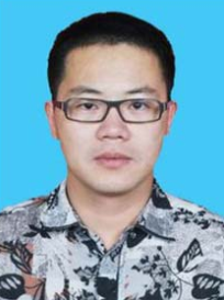
Ming Gao, male, the Han nationality, CPC member, bachelor’s degree, born in Fuzhou City, Fujian Province in July 1987. He graduated from School of Environment and Resource of Southwest University of Science and Technology majored in surveying and mapping engineering in 2009. He is now working in the Second Geological Exploration Institute of China Metallurgical Geology Bureau. He has published many professional papers in various journals. He presided over the completion of hundreds of surveying and mapping tasks and participated in a number of surveying and mapping contents included in national and provincial key geological exploration projects. He has won the honorary title of advanced worker and advanced individual.
高明,男,汉族, 1987 年 7 月生,福建福州人,中国共产党党员。 2009 年毕业于西南科技大学环境与资源学院测绘工程专业,本科学历。现就职于中国冶金地质总局第二地质勘查院。多次在各种刊物上发表专业论文。主持完成测绘工作任务数百项,主持参与多项国家级、省级重点地质勘探项目中所包含的测绘内容。曾获得先进工作者、先进个人等光荣称号。

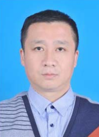
Yue-Wei Bo, male, the Han nationality, bachelor’s degree, born in Weifang City,Shandong in July 1981. He graduated from Shandong University of Science and Technology in 2015. He is now the director of the Fourth Geological and Mineral Exploration Institute of Shandong Province, and he is responsible for surveying and mapping geographic information work. He has won the title of “young post expert” of Shandong Geological and Mineral Exploration and Development Bureau.
薄曰伟,男,汉族, 1981 年 7 月生,山东潍坊人, 2015 年毕业于山东科技大学,本科学历。 现于山东省第四地质矿产勘查院任职主任职位, 负责测绘地理信息工作,获得山东省地质矿产勘查开发局“青年岗位能手”称号。